Last updated: · 15 min read
In brief
Fifty kilometers from a disputed border, China is building the world’s largest planned hydropower project, nearly triple the Three Gorges Dam’s capacity. Below it, the river enters India as the Brahmaputra. Since 1950, China has held the upstream position on rivers flowing into ten countries. No treaty binds it. On the Mekong, its dams were found to hold back more water than ever in a record-low year, a finding China rejects. India now plans its own megadam downstream, with Bangladesh beneath them both.
Contents
The canyon begins at the bend. For fifty kilometers, the Yarlung Tsangpo River falls two thousand meters through the eastern Himalayas, cutting one of the deepest river gorges on the planet before crossing into India and becoming the Brahmaputra. On Christmas Day 2024, Beijing announced its approval of the world’s largest planned hydropower project at this precise site: a cascade of five power stations with up to 60 gigawatts of capacity, nearly three times that of the Three Gorges Dam. Early estimates were lower; by the time Premier Li Qiang broke ground on July 19, 2025, the official cost had risen to 1.2 trillion yuan, about $167 billion.
The site is fifty kilometers from a disputed border. Two countries that are now nuclear powers fought a war over this frontier in 1962, and their soldiers killed each other along it in 2020. What a power station at this spot means to both of them starts with the plateau above it.
The Machine on the Roof of the World
At an average of more than 4,500 meters above sea level, the Tibetan Plateau is the highest and largest plateau on Earth, covering 2.5 million square kilometers, about ten times the area of the United Kingdom. Its height is what lets it shape the climate around it.
In summer, the plateau works like a giant hotplate raised into the middle of the atmosphere. Its sunlit surface pours heat into air four to five kilometers above sea level. Along its southern edge, the Himalayan wall seals the warm, moist air over India off from the cold, dry air of the continental interior. Hotplate and wall together help draw moist air northward from the Indian Ocean in a massive seasonal circulation: the South Asian monsoon. Climate modelers still argue over which matters more; in some models the mountain wall alone can sustain the monsoon.
Between June and September, the monsoon delivers roughly three quarters of India’s total rainfall. Crops, groundwater recharge, drinking water for cities, river flow in the dry season: all of it is downstream of the monsoon, which is itself downstream of the mountains. Hundreds of millions of smallholder farmers across India, Pakistan, Bangladesh, and Nepal feel it within weeks when the monsoon fails or arrives late: nearly half of India’s farmland has no irrigation at all.
The Indian subcontinent and North Africa sit at nearly identical latitudes, yet North Africa is the Sahara and South Asia is farmland feeding well over a billion people. The difference is the wall of mountains and high plateau to the north — one that deflects the jet stream, blocks cold, dry air from spilling south, and lets the summer pressure gradient pull ocean moisture deep inland. Its reach extends east as well: by diverting the westerly winds, the plateau also shapes the East Asian summer monsoon rains downstream.
The Third Pole
The plateau’s second function is storage. The Tibetan Plateau and its surrounding ranges, the Himalayas, Hindu Kush, Pamir, and Karakoram, harbor the largest concentration of glacier ice anywhere outside the Arctic and Antarctic. Glaciologists call it the Third Pole.
Ten major river systems draw on these mountains. Flowing east into China and Southeast Asia: the Yangtze, Asia’s longest river; the Yellow River; the Mekong, which passes through Myanmar, Laos, Thailand, Cambodia, and Vietnam before reaching the South China Sea; the Salween. Flowing south: the Irrawaddy, which runs the length of Myanmar; the Brahmaputra, which enters India through Arunachal Pradesh and crosses Bangladesh to the Bay of Bengal; the Ganges, which rises at the Gangotri Glacier on the Indian side of the Himalaya; the Indus, which runs through India and Pakistan. And beyond the western and northern ranges: the Amu Darya, which runs toward the Aral Sea, and the Tarim, which fades into the deserts of Xinjiang.
The International Centre for Integrated Mountain Development (ICIMOD), the region’s eight-nation science body, estimates that the rivers fed by these mountains supply about 240 million people in the mountains themselves and another 1.65 billion downstream, close to two billion in all. The monsoon’s reach is wider still, taking in almost every farm between the Indus and the Bay of Bengal. These are different claims: the first is about rivers, the second about rain.
The glaciers do something the monsoon doesn’t: they sustain river flow when rain has stopped. For the upper Indus basin in particular, glacier and snowmelt provides a disproportionate share of peak summer flows — considerably more than in the monsoon-dominant rivers to the east, and the reason Pakistan faces sharper exposure than India when the glacial contribution begins to fall. The upper Indus is more glacier-dependent because it sits furthest from the monsoon’s core reach; it depends on frozen storage the way the rest of South Asia depends on rain.
The glaciers are retreating. They lost mass 65 percent faster in 2011–2020 than in the decade before. Even if global warming is held to 1.5 degrees, the region’s glaciers will lose more than a third of their ice by 2100; if emissions are not cut, about two thirds. The short-term effect is more meltwater as stored ice releases — rivers swell temporarily, masking the threat. The medium-term effect, as glaciers thin and vanish, is less meltwater in the dry months, felt hardest in glacier-fed basins like the upper Indus.
Sidebar A: The Peak Water Problem

Before glaciers disappear, they first release more water. This is called "peak water" — the moment at which accelerating melt produces maximum runoff before the glacier becomes too thin to sustain it. Across the Hindu Kush Himalaya as a whole, ICIMOD expects meltwater to peak around the middle of this century and then decline. Some basins will get there sooner, others later.

The practical consequence is paradoxical: rivers fed by retreating glaciers can be at historically high flow right now, even as the long-term trajectory bends toward scarcer water in the dry months. For the Indus system, peak water arrival means a period of high flows followed by a shrinking supply of meltwater. Pakistan, which depends on Indus water for one of the world's largest irrigation systems, faces the most acute exposure.

Upstream dams can change a river's timing now, and their operators can rewrite the schedule from one season to the next. Glacier loss works over decades, and no one can schedule it back.
The Acquisition
The monsoon engine, the glacier bank and the river systems descending to ten downstream countries were all politically neutral until October 1950, when the People’s Liberation Army entered Tibet.
The Chinese government called it liberation. The government in Lhasa called it invasion. Tibet was formally incorporated into the People’s Republic under the Seventeen Point Agreement of 1951, signed under military duress. The primary strategic calculations were territorial — securing the PRC’s national boundary on the ethnic-nationalist terms the new state had defined for itself, establishing a buffer against India and the Western powers, and keeping Tibet out of American reach in the opening decade of the Cold War. There is no reliable evidence that Mao Zedong’s strategic calculus explicitly prioritized hydraulic resources.
What China inherited in 1950 was the upstream position on rivers flowing into India, Pakistan, Bangladesh, Nepal, Bhutan, Myanmar, Thailand, Cambodia, Laos, and Vietnam. Few territorial acquisitions of the twentieth century handed one state hydraulic leverage over so many downstream populations at once.
China has no comprehensive water-sharing treaty with any downstream riparian state, so no treaty constrains how it uses that position. The Mekong River Commission, established in 1995, has China as a dialogue partner but not a full member; China is not bound by its decisions or obligations. No equivalent governance body exists for the Brahmaputra. The 1996 Ganges Water Treaty between India and Bangladesh governs that bilateral relationship but is silent on Chinese upstream behavior. Water scholars call this structural condition “hydro-hegemony.” By 2011, Brahma Chellaney was warning that China’s upstream position turns Asia’s rivers into a theater of rivalry, and China has built more dams since.
The Architecture of Leverage
On two rivers, downstream countries have already felt that upstream position, or believe they have.
The first is the Mekong. By the time of the 2019 drought, China had built a cascade of eleven large dams on its section of the mainstream, together storing about as much water as Chesapeake Bay. Myanmar, Laos, Thailand, Cambodia, and Vietnam collectively depend on the river downstream for irrigation, fisheries, and drinking water for tens of millions of people. They have no mechanism to constrain Chinese dam operations.
In April 2020, a US government-funded analysis by Alan Basist and Claude Williams of Eyes on Earth, a US research firm, combined satellite measurements of surface wetness with river-gauge records to reconstruct how the upper Mekong would have flowed without China’s dams. It found that throughout most of 2019, rain and snowmelt in the Chinese portion of the catchment were normal to above average, yet China’s dams held back more water than ever, restricting wet-season flows to maximize dry-season generation, when electricity sells for much more. Downstream, the river fell to its lowest level on record in northern Thailand; fisheries collapsed and crops failed. A satellite-data problem forced a correction in 2021; the Stimson Center, which had publicized the analysis, reported that the revised model still supported the core finding.
China rejected the study’s conclusions, saying the Lancang basin had been in drought too. The Mekong River Commission was cautious as well: it and independent reviewers questioned the report’s methods, noting that it measured river levels rather than volumes and had not been peer-reviewed, while the commission used the uproar to press Beijing for data. In October 2020 China agreed to share year-round rainfall and river-level readings from two of its Mekong stations. The commission still has no authority to make China release a drop. Its own later assessment, after three straight years of low flows, named unusually low rainfall and a worsening climate, rather than upstream storage, as the main driver, while finding that the reservoirs had delayed the annual flood pulse.
The second is the Brahmaputra. In 2017, the year Indian and Chinese forces faced off for 73 days at Doklam, a plateau at the India–China–Bhutan trijunction that Bhutan and China both claim, China sent India none of the flood-season hydrological data for the Brahmaputra that India pays for under bilateral agreements. Readings from upstream stations in Tibet help India forecast flood surges bearing down on Assam and the northeastern states; none has arrived since the last agreement lapsed in June 2023. China’s stated reason was upgrades to measurement stations in Tibet. At the same time, China continued sharing the same data with Bangladesh.
Many in India read the gap as pressure: flood warnings withheld from a rival during a military standoff and still sent to the neighbor that posed no threat. The case was never proven. The data season opens in mid-May, weeks before the face-off began, and India’s own foreign ministry called it premature to link the two.
Sidebar B: The "Run-of-River" Question

China's official description of the Yarlung Tsangpo dam is a "run-of-river" hydropower scheme: water passes through turbines and returns to the river without large-scale reservoir impoundment. This framing is used to deflect concerns about weaponization: without a reservoir, the argument goes, China cannot impound water at meaningful scale.

The argument has limits. Run-of-river dams still affect flow timing and sediment loads, both of which downstream agriculture and flood-control systems depend on. Even without a large reservoir, a structure controlling a canyon choke point can shift when water arrives downstream; how far depends on how much the scheme can store. China's Mekong cascade shows how much a chain of upstream dams can reshape a river's timing: in 2019, the Eyes on Earth analysis found, its dams held back enough water for months to cancel the annual monsoon rise in the river's level in northern Thailand, an estimate other hydrologists dispute.

How much that matters is disputed. The development scholar Hong Zhang argues that a tunnel-diversion scheme without high storage dams has limited capacity to interrupt downstream flows, and cites estimates that less than 30 percent of the Brahmaputra's water comes from China at all, with most added by rain and tributaries in India and Bhutan. The framing also leaves out sediment: the canyon is estimated to supply about 45 percent of the sediment the Brahmaputra carries downstream, and bypassing it could starve the river's lower reaches and delta. Either way, a structure at this location puts China's hand on the river at the precise point where it gathers its force before crossing into India.The Border Dispute, Reframed
The India-China border conflict is almost always narrated as territorial nationalism: two large states with overlapping claims, a humiliating war in 1962, a Line of Actual Control that neither side has formally defined, and periodic incidents where soldiers push into the same mountain valley. That account explains much of the dispute, but not its specific patterns: why China presses its claim to the eastern sector so persistently, and why certain valleys matter more than the maps suggest.
The border runs in three sectors. In the west: Aksai Chin, a high-altitude desert administered by China and claimed by India as part of Ladakh, its eastern part draining into small alkaline lakes rather than out to the sea. The road China built across it in the 1950s to link Tibet with Xinjiang is today’s G219 highway. China holds this primarily for interior connectivity reasons; the hydraulic argument is weakest here. In the middle, where Tibet faces the Indian states of Himachal Pradesh and Uttarakhand, the line is the least contested. In the east: Arunachal Pradesh, administered by India, claimed by China as “Zangnan” — South Tibet.
Arunachal Pradesh is the territory through which the Yarlung Tsangpo descends from the Tibetan Plateau into India. The river enters Arunachal after exiting Tibet; the canyon where the dam is being built is fifty kilometers from the McMahon Line — the boundary India recognizes and China does not. Control of the Indian-administered side of this border would give China territorial reach over the last segment of the Brahmaputra’s plateau descent before it enters the Assam plain. In the eastern sector, the disputed border and the line where the river leaves Chinese control are the same line.
The 1962 war ended with China in control of Aksai Chin, which it needed for the Tibet-Xinjiang road, and India retaining Arunachal Pradesh. Water was not what the 1962 campaign was fought over; the evidence points to Aksai Chin, buffer territory and military demonstration. The outcome still left China holding the upper Brahmaputra and India holding the territory through which the river crosses into Indian administrative control. China has contested India’s hold on the eastern sector continuously in the six decades since.
In June 2020, in the Galwan Valley in the western sector, twenty Indian soldiers and at least four Chinese soldiers died in hand-to-hand fighting — the first confirmed combat deaths on this border in 45 years. The backdrop was a large Chinese advance into several areas of Ladakh that spring, apparently prompted by Beijing’s alarm at India’s bolder approach along the border. Galwan was about roads and Chinese sensitivity to Indian military access along the LAC; water played little part.
Whatever drove each clash, the eastern claim lines up with the river. Read this way, the dispute in the east follows the water even where individual incidents did not.
In October 2024, India and China reached a patrol agreement that ended a four-year military standoff at several LAC friction points; it said nothing about water. In July 2025, construction began on the Yarlung Tsangpo dam. In October 2025, India’s Central Electricity Authority published a master plan for the transmission lines needed to carry about 76 gigawatts of hydropower out of the Brahmaputra basin by 2047, with Arunachal Pradesh at its center: most of it from conventional hydro projects not yet built, plus 11 gigawatts of pumped storage. The state’s chief minister, Pema Khandu, presents its flagship, the proposed 11,000-megawatt Siang Upper Multipurpose Project, as a matter of national security and a buffer against Chinese releases upstream.
Sidebar C: The End of the River

Bangladesh sits at the confluence of the Brahmaputra and the Ganges, downstream of both countries' dam-building races. It has no water-sharing treaty with China, had no say in the Yarlung Tsangpo dam, and has no seat in any India-China border negotiation.

Bangladesh's farmland along the Jamuna, as the Brahmaputra is called there, depends on the river's floods for soil replenishment and irrigation. As India builds more dams in Arunachal Pradesh, it gains its own upstream leverage over Bangladesh, which has no capacity to counter it. The logic is a cascade: each upstream state secures its position before its downstream neighbor can establish counter-leverage, from China to India to Bangladesh, the last country on the river.
The Water Conflict So Far
The phrase “water wars” has been a fixture of geopolitical forecasting since the 1990s, appearing in think-tank reports and UN warnings with sufficient regularity to have become, through repetition, nearly meaningless. It is consistently future-tense, always about a coming crisis or a potential flashpoint.
In 2019, though, downstream Mekong countries saw record-low river levels while, by Eyes on Earth’s reconstruction, China’s dams were holding back more water than in any comparable period. The economic incentive was clear: electricity sells for much more in the dry season.
The cost fell downstream. No treaty was violated, and no legal mechanism produced a remedy. Large-scale hydropower and sand mining across the basin now threaten the livelihoods of 70 million people, and the International Crisis Group judges that none of the six Mekong states, China included, has struck a satisfactory balance between growth and the river that sustains it.
The Brahmaputra front is at an earlier stage, but the infrastructure is being installed. The Yarlung Tsangpo project puts 60 gigawatts of turbines where the river leaves the plateau for India. Its official price tag, about $167 billion, is roughly twice India’s entire defense budget for 2026–27. Construction is projected to complete around 2033. India’s counter-program is a $77 billion plan to carry the Brahmaputra basin’s hydropower to the national grid, built around a Siang megadam its backers sell as a national-security buffer.
No binding agreement commits China to share the water of the Brahmaputra or the Mekong. The 1997 UN Watercourses Convention, which establishes principles of equitable utilization and the obligation not to cause significant harm to co-riparian states, has 43 parties as of October 2026. Neither India nor China is among them. China voted against adoption in 1997; India abstained.
The region’s negotiated water frameworks are bilateral and fragile. The Indus Waters Treaty between India and Pakistan, brokered by the World Bank in 1960, survived decades of hostility — until India placed it “in abeyance” in April 2025 after the Pahalgam attack. In August 2026 a Court of Arbitration ruled that the treaty remains fully in force; India rejects the court’s jurisdiction. The Ganges Water Treaty between India and Bangladesh expires in December 2026, with its renewal still unresolved. No equivalent architecture exists for the Brahmaputra.
The plateau itself is mostly dry — the Himalayas wring out the monsoon before it arrives, and most of Tibet gets less than half a meter of rain and snow a year. China leans heavily on the Yangtze and the Yellow River, which flow through its own heartland. But the Brahmaputra, the Mekong, the Salween and the Indus carry Tibetan water away from China, toward populations that need it far more than Beijing does. On those rivers, the state that depends on them least sits at the top.
The Canyon, Revisited
When the turbines turn, the Yarlung Tsangpo project will be the world’s largest hydropower installation, and Beijing alone will set its operating schedule.
A binding Brahmaputra governance framework comparable to the Indus Waters Treaty would require China to accept constraints on infrastructure it is spending 1.2 trillion yuan to build. Chinese membership in a functional Brahmaputra commission would require Beijing to accept obligations it explicitly rejected in 1997. Neither exists, and neither is being negotiated.
From the canyon, the river descends into Arunachal Pradesh, where India wants its own megadam on the Siang as a buffer against whatever Beijing releases, and then into Bangladesh, which has no water treaty for this river with either of them. The same two-thousand-meter drop that makes the canyon one of the greatest untapped hydropower resources on Earth now stacks two dam-building states one above the other on the same river, with Bangladesh beneath them both.
Related articles
- The slow death of America’s most heavily pumped aquifer
- Why desalination hasn’t solved the water crisis — and what actually would
- How a wet country runs short of water
Further reading
As an Amazon Associate, Eikleaf earns from qualifying purchases. The book links below are affiliate links: if you buy through them, we may earn a small commission at no extra cost to you.
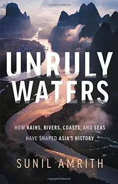 Unruly Waters: How Mountain Rivers and Monsoons Have Shaped South Asia’s HistoryExplains how monsoons, mountain rivers and efforts to control water shaped South Asian development and international tensions.
 Himalaya: A Human HistoryProvides the regional history behind Tibet’s strategic position, competing empires and disputed Himalayan frontiers.
 Prisoners of Geography: Ten Maps That Tell You Everything You Need to Know About Global PoliticsIts China and India–Pakistan chapters explain how Tibet, river headwaters and mountain barriers shape regional security.
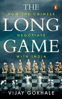 The Long Game: How the Chinese Negotiate with IndiaUses six diplomatic episodes, including Tibet and Sikkim, to explain the bargaining behind India–China rivalry in the Himalayas.
Recommended videos
 11:31How the Himalayas Changed the WorldPBS Eons on how the rise of the Himalayas and Tibetan Plateau reshaped Asia’s climate and monsoon.
 14:36Inside China’s Controversial $167 Billion Mega-DamBloomberg inside China’s Yarlung Tsangpo mega-dam, the headwaters project the article discusses.
 16:27India, China dams spark fears of water dispute, displacement | BBC News IndiaBBC on how dueling Chinese and Indian dams on the Brahmaputra raise fears downstream.
Cite this article
Ulfur Atli. “The mountain range that determines Asia’s weather — and its wars.” Eikleaf, 12 May 2026, updated 2 November 2026. https://www.eikleaf.com/the-mountain-range-that-determines-asias-weather-and-its-wars/
Gen AI Disclaimer
Some contents of this page were generated and/or edited with the help of a Generative AI.
Media
Key Sources and References
The plateau, the monsoon and the glaciers
Boos, W. R. and Kuang, Z., “Dominant control of the South Asian monsoon by orographic insulation versus plateau heating,” Nature 463, 218–222, 2010. DOI: 10.1038/nature08707. https://doi.org/10.1038/nature08707
Son, J.-H., Seo, K.-H. and Wang, B., “How Does the Tibetan Plateau Dynamically Affect Downstream Monsoon Precipitation?” Geophysical Research Letters 47, 2020. DOI: 10.1029/2020GL090543. https://doi.org/10.1029/2020GL090543
Ye, D.-Z. and Wu, G.-X., “The role of the heat source of the Tibetan Plateau in the general circulation,” Meteorology and Atmospheric Physics 67, 181–198, 1998. DOI: 10.1007/BF01277509. https://doi.org/10.1007/BF01277509
India Meteorological Department, press release on new rainfall normals (southwest monsoon: 74.9 percent of annual rainfall), April 2022 (archived copy). https://web.archive.org/web/20260509054819/https://internal.imd.gov.in/press_release/20220414_pr_1572.pdf
Al Jazeera, “The annual southwest monsoon in South Asia,” May 10, 2017. https://www.aljazeera.com/economy/2017/5/10/the-annual-southwest-monsoon-in-south-asia
Encyclopaedia Britannica, “Tibet: Climate”; “Ganges River”; “Brahmaputra River”; “Aksai Chin.” https://www.britannica.com/place/Tibet/Climate · https://www.britannica.com/place/Ganges-River · https://www.britannica.com/place/Brahmaputra-River · https://www.britannica.com/place/Aksai-Chin
International Centre for Integrated Mountain Development (ICIMOD), “Water, Ice, Society, and Ecosystems in the Hindu Kush Himalaya: An Outlook” (HI-WISE), press release, June 20, 2023. https://www.icimod.org/wp-content/uploads/PR_HI-WISE-Report-Final.pdf
International Centre for Integrated Mountain Development (ICIMOD), “Major River Basins in the Hindu Kush Himalaya (HKH) Region,” Regional Database System, 2010. https://rds.icimod.org/metadata/731cca1c-a572-4924-9a90-0cfa64bbe9b6
Mountain Research Initiative, “Landmark study warns two degree temperature rise could melt third of Himalayan glaciers” (on the Hindu Kush Himalaya Assessment), 2019. https://mountainresearchinitiative.org/news/landmark-study-warns-two-degree-temperature-rise-could-melt-third-of-himalayan-glaciers/
Council on Foreign Relations, “Water Clouds on the Tibetan Plateau,” backgrounder. https://www.cfr.org/backgrounders/water-clouds-tibetan-plateau
Tibet and the politics of water
Goldstein, Melvyn C., A History of Modern Tibet, 1913–1951: The Demise of the Lamaist State, University of California Press, 1989. https://openlibrary.org/works/OL2624799W
Shakya, Tsering, The Dragon in the Land of Snows: A History of Modern Tibet Since 1947, Pimlico, 1999. https://openlibrary.org/works/OL224356W
Zeitoun, M. and Warner, J., “Hydro-hegemony – a framework for analysis of trans-boundary water conflicts,” Water Policy 8, 435–460, 2006. DOI: 10.2166/wp.2006.054. https://doi.org/10.2166/wp.2006.054
Chellaney, Brahma, Water: Asia’s New Battleground, Georgetown University Press, 2011. https://openlibrary.org/works/OL16183708W
Manhas, N. S. and Yadav G, H., “Beyond the Border: Exploring the Complex Dynamics of Water Tensions Between India and China,” Discover Global Society 2, 2024. DOI: 10.1007/s44282-024-00089-x. https://doi.org/10.1007/s44282-024-00089-x
The Mekong
Mekong River Commission, “Dialogue Partners.” https://www.mrcmekong.org/dialogue-partners/
Basist, A. and Williams, C., Eyes on Earth, “Monitoring the Quantity of Water Flowing Through the Upper Mekong Basin Under Natural (Unimpeded) Conditions,” 2020; as reported by Mongabay, “China held water back from drought-stricken Mekong countries, report says,” April 2020, and Radio Free Asia, “China’s Mekong River Dams Compounded 2019 Drought, US-Funded Study Claims,” April 2020. https://news.mongabay.com/2020/04/china-held-water-back-from-drought-stricken-mekong-countries-report-says/ · https://www.rfa.org/english/news/china/mekong-drought-04132020190929.html
Eyler, Brian, and Weatherby, Courtney, “New Evidence: How China Turned Off the Tap on the Mekong River,” Stimson Center, April 13, 2020 (with editor’s note of May 8, 2021). https://www.stimson.org/2020/new-evidence-how-china-turned-off-the-mekong-tap/
Mekong River Commission, commentary note on Basist and Williams (2020), 2020; discussed in Aalto University Water and Development Research Group, “Critical nature: are China’s dams on the Mekong causing downstream drought?” https://wdrg.aalto.fi/critical-nature-are-chinas-dams-on-the-mekong-causing-downstream-drought-the-importance-of-scientific-debate/
Mekong River Commission, “Mekong countries urged to take bold actions as the river experiences three consecutive years of low flows,” media release, 2022. https://www.mrcmekong.org/media-releases/mekong-countries-urged-to-take-bold-actions-as-the-river-experiences-three-consecutive-years-of-low-flows/2022/
Mekong River Commission, “Mekong water levels reach low record,” media release, July 18, 2019 (via Open Development Laos). https://laos.opendevelopmentmekong.net/news/mekong-water-levels-reach-low-record/
Heinrich Böll Foundation, “Beyond Water Data Sharing, Mekong-Lancang River Needs Accountable Water Governance,” November 27, 2020. https://th.boell.org/en/2020/11/27/mekong-lancang-river-needs-accountable-water-governance
International Crisis Group, “Dammed in the Mekong: Averting an Environmental Catastrophe,” Asia Report No. 343, 2024. https://www.crisisgroup.org/asia/south-east-asia/cambodia-thailand-china/343-dammed-mekong-averting-environmental-catastrophe · https://icsfarchives.net/20938/
The Brahmaputra and the Yarlung Tsangpo project
Zhang, Hong, “Infrastructure and State-Building: China’s Ambitions for the Lower Yarlung Tsangpo Project,” Made in China Journal, August 7, 2025. https://madeinchinajournal.com/2025/08/07/infrastructure-and-state-building-chinas-ambitions-for-the-lower-yarlung-tsangpo-project/
Garcia, Zenel, and Phillip Guerreiro, “The Technopolitics of China’s Yarlung Tsangpo Dam Project and the Paradox of Hydropower,” Made in China Journal, September 4, 2025. https://madeinchinajournal.com/2025/09/04/the-technopolitics-of-chinas-yarlung-tsangpo-dam-project-and-the-paradox-of-hydropower/
Jamestown Foundation, “Harnessing Hydropower, Sparking Tensions: PRC Mega-Dam and India’s Water Security Fears,” China Brief, 2025. https://jamestown.org/harnessing-hydropower-sparking-tensions-prc-mega-dam-and-indias-water-security-fears/
ENR, “China launches construction of megadam project,” July 2025. https://www.enr.com/articles/61081-china-launches-construction-of-megadam-project
Pearce, Fred, “China’s Mega Dam Project Poses Big Risks for Asia’s Grand Canyon,” Yale Environment 360, May 14, 2025. https://e360.yale.edu/features/china-tibet-yarlung-tsangpo-dam-india-water
Wuthnow, Joel, “Did China Use Water as a Weapon in the Doklam Standoff?,” War on the Rocks, October 4, 2017. https://warontherocks.com/did-china-use-water-as-a-weapon-in-the-doklam-standoff/
ThePrint (Bloomberg), “India seeks water flow data from China as concerns mount over Beijing’s construction of mega dam,” August 7, 2026. https://theprint.in/india/india-seeks-water-flow-data-from-china-as-concerns-mount-over-beijings-construction-of-mega-dam/3008738/ · Eastern Mirror, “MoU on the Brahmaputra river,” September 19, 2025. https://www.easternmirrornagaland.com/mou-on-the-brahmaputra-river
The Morung Express (news agencies), “Assam floods: The China connection,” August 20, 2017. https://morungexpress.com/assam-floods-china-connection
Power Line, “CEA issues roadmap for evacuation of 76 GW hydropower from Brahmaputra basin by 2047,” October 15, 2025; Enerdata, “India unveils US$77bn master plan to boost hydropower in Brahmaputra Basin,” October 15, 2025. https://powerline.net.in/2025/10/15/cea-issues-roadmap-for-evacuation-of-76-gw-hydropower-from-brahmaputra-basin-by-2047/ · https://www.enerdata.net/publications/daily-energy-news/india-unveils-us77bn-master-plan-boost-hydropower-brahmaputra-basin.html
Central Electricity Authority (India), “Master Plan for Evacuation of Power from Hydroelectric Plants in Brahmaputra Basin,” October 2025 (copy hosted by the BIMSTEC Energy Centre). https://bimstecenergycentre.org/wp-content/uploads/2025/11/India_Master-Plan-for-Evacuation-of-Power-from-Hydroelectric-Plants-in-the-Brahmaputra-Basin.pdf
The Hans India (IANS), “Siang multi-purpose project is a national project with strategic, security implications: Arunachal CM,” 2026; DT Next, “Siang project not just for generating power but mitigating flood risks posed by China: Arunachal CM.” https://www.thehansindia.com/news/national/siang-multi-purpose-project-is-a-national-project-with-strategic-security-implications-arunachal-cm-1127049 · https://www.dtnext.in/amp/story/news/national/siang-project-not-just-for-generating-power-but-mitigating-flood-risks-posed-by-china-arunachal-cm-817183
Press Information Bureau, Government of India, “Union Budget 2026–27: Ministry of Defence,” February 2026; Janes, “India announces USD85.5 billion defence budget for FY 2026–27,” February 3, 2026. https://static.pib.gov.in/WriteReadData/specificdocs/documents/2026/feb/doc202623778301.pdf · https://www.janes.com/defence-intelligence-insights/defence-news/industry/update-india-announces-usd855-billion-defence-budget-for-fy-202627
The border
International Crisis Group, “Thin Ice in the Himalayas: Handling the India-China Border Dispute,” Asia Report No. 334, November 14, 2023. https://www.crisisgroup.org/asia/south-asia/india-china/334-thin-ice-himalayas-handling-india-china-border-dispute
Arms Control Association, “Nuclear Weapons: Who Has What at a Glance.” https://www.armscontrol.org/factsheets/nuclear-weapons-who-has-what-glance
Indian Defence Review, “Beware India: China’s most strategic road” (G219 Xinjiang–Tibet highway). https://indiandefencereview.com/beware-india-chinas-most-strategic-road/
The Tribune, “Back to 2020 situation: India, China reach pact on patrolling along LAC,” October 21, 2024. https://www.tribuneindia.com/news/india-china-agree-on-patrolling-agreement-along-lac/
Water law and treaties
UN Treaty Collection, Convention on the Law of the Non-navigational Uses of International Watercourses, status of parties, checked October 2026. https://treaties.un.org/Pages/ViewDetails.aspx?src=TREATY&mtdsg_no=XXVII-12&chapter=27&clang=_en
United Nations General Assembly, press release GA/9248, “General Assembly adopts convention on law of non-navigational uses of international watercourses,” May 21, 1997. https://www.internationalwaterlaw.org/documents/intldocs/convention_press.html
Drishti IAS, “India Rejects Hague Court’s Ruling on Indus Waters Treaty,” September 2, 2026; The News International, “India must uphold water sharing treaty with Pakistan, says arbitration court,” 2026. https://www.drishtiias.com/daily-updates/daily-news-analysis/india-rejects-hague-courts-ruling-on-indus-waters-treaty/print_manually · https://www.thenews.pk/story/1434857-india-must-uphold-water-sharing-treaty-with-pakistan-says-arbitration-court
Outlook India, “Ganga Water Treaty Explained: Why India And Bangladesh Are Discussing Its Renewal,” August 4, 2026. https://www.outlookindia.com/international/ganga-water-treaty-explained-why-india-and-bangladesh-are-discussing-its-renewal