Last updated: · 14 min read
In brief
When an American destroyer crosses the Spratlys, Washington and Beijing cite the same treaty. China ratified it; the United States never has. The UN Convention on the Law of the Sea says precisely where each ocean zone ends and which features count as islands. In 2016 a tribunal found no legal basis for China’s claimed historic rights inside the nine-dash line. Beijing called the award null and void. The treaty cannot compel a great power that refuses to comply, and China’s artificial islands remain, occupied and fortified.
Contents
In a typical encounter, an Arleigh Burke-class guided-missile destroyer transits the Spratly Islands. People’s Liberation Army Navy ships shadow it, broadcasting warnings over marine radio. Washington calls the transit routine. Beijing calls it an illegal incursion into sovereign waters.
Both governments are invoking the same treaty. The United States describes the operation as a freedom-of-navigation exercise conducted under UNCLOS, the UN Convention on the Law of the Sea, which its lawyers cite by article number. China, which ratified UNCLOS in 1996, declares the transit a violation of the same treaty. The United States has never ratified it at all.
One country is enforcing a treaty it hasn’t joined. The other joined the treaty and declared its rulings inapplicable when they went against it.
The treaty itself, with 320 articles, nine annexes, its own international courts and three decades of jurisprudence, can say precisely where each zone ends and which features count as islands, but it has no means of compelling a great power that refuses to comply.
Lines on Water
The Third UN Conference on the Law of the Sea, which produced UNCLOS, ran from 1973 to 1982 with roughly 160 nations at the table. Its ambition was to write down precisely who owns what in the ocean.
Before UNCLOS, the answer was a muddle. The 1958 Geneva Conventions had codified some maritime norms but left the central question unresolved: how far out a coastal state’s claim extends. Different states asserted anything from three nautical miles to two hundred. Fishing vessels were impounded and fishermen arrested in waters their families had worked for generations, while offshore oil rigs became contested ground. UNCLOS resolved this through zones, each with a distinct legal character.
The innermost is the territorial sea, running twelve nautical miles from a coastal state’s baseline. Within it, the state exercises full sovereignty, with the same legal status as its land, extending to the airspace above and seabed below. Foreign ships, warships included, may transit under the doctrine of innocent passage. They must keep moving continuously and expeditiously, stopping or anchoring only when ordinary navigation, distress, or a rescue calls for it, and they may do nothing prejudicial to the coastal state’s peace, good order or security, a test the treaty spells out in a list that runs from weapons exercises and intelligence gathering to fishing and surveys. But the zone belongs to the coastal state.
Beyond twelve miles and out to twenty-four runs the contiguous zone, where a state has enforcement powers without sovereignty. A government can act there to prevent and punish violations of its customs, immigration, fiscal, and sanitary laws, but only violations committed, or about to be committed, within its territory or territorial sea.
The zone that drives the conflicts comes next. Out to 200 nautical miles from the baseline, the coastal state holds an Exclusive Economic Zone: sovereign rights to fish, drill, mine, and generate energy within those waters. It has no sovereignty over the water column itself, so foreign ships pass freely and foreign aircraft fly overhead, but it controls the resources, down to deciding who else may fish any surplus it cannot catch itself. The 1958 Geneva Conventions had no such zone. Chile, Peru, and Ecuador pioneered 200-mile claims in the late 1940s and early 1950s; UNCLOS turned their idea into universal law.
The Maldives has a total land area of roughly 298 square kilometers, scattered across a chain of coral atolls. Its EEZ covers roughly 900,000 square kilometers of the Indian Ocean. That jurisdictional footprint is about three thousand times its land area, and it exists entirely because the Maldives has a coastline.
Beyond 200 miles, where the seabed is a geological extension of a state’s continental landmass, UNCLOS lets a state claim seabed to the outer edge of its continental margin, measured by formulas in Article 76 and capped at either 350 nautical miles or 100 nautical miles beyond the line where the seabed reaches 2,500 meters deep; on submarine ridges, generally only the 350-mile cap applies. These require scientific submissions to the Commission on the Limits of the Continental Shelf, which reviews them and issues recommendations. In the Arctic, Russia, Canada, and Denmark have each filed overlapping claims asserting rights to the same submarine ridge. Russia revised its submission in 2015; the CLCS adopted recommendations on it in February 2023, and Moscow followed up within months with two more revised submissions, one of them returning to the Gakkel Ridge area. But the CLCS judges the science; it does not draw borders. Where two states have each submitted scientifically credible claims to the same area, the boundary between them falls to bilateral negotiation. Russia and Norway managed this: a 2010 delimitation treaty settled a forty-year Barents Sea dispute. Russia, Canada, and Denmark have not resolved theirs.
Add up every EEZ asserted by every coastal state and the total covers roughly 36 percent of the world’s ocean surface. Together with the continental shelves beyond them, those zones place almost all of the world’s fisheries and close to nine-tenths of its known and estimated undersea oil and gas under some state’s jurisdiction. That coastal belt is fully addressed, often by more than one state at once.
The High Seas and the Common Heritage Principle

On November 1, 1967, Arvid Pardo, Malta's ambassador to the United Nations, rose in the General Assembly's First Committee and proposed something radical: the seabed beyond national jurisdiction should be declared the "Common Heritage of Mankind." No state would own it; it would be managed collectively, with revenues shared among all nations. UNCLOS Part XI enacted this, creating the International Seabed Authority to govern deep-sea mining in international waters and directing a share of its revenues to developing nations.

Reagan refused to sign UNCLOS in 1982. Part XI was the stated reason: his administration objected that the deep-seabed regime would deter mining, deny the US a decision-making role matching its interests, force the transfer of private technology, and let amendments bind the US without its consent. The 1994 Implementation Agreement then rewrote the heart of Part XI: production limits scrapped, mandatory technology transfer removed, and a seat on the ISA's decision-making Council reserved for the state that had the world's largest economy when the Convention entered into force in November 1994. That state is the United States, should it ever join. The Senate still hasn't approved it.
Where the Lines Fight Each Other
The South China Sea covers almost 3.5 million square kilometers. Six governments claim pieces of it: China, Taiwan, Vietnam, the Philippines, Malaysia, and Brunei. Extend 200-nautical-mile EEZs from each of their coastlines and islands and the circles pile on top of one another.
China’s claim is distinctive and, from a legal standpoint, deliberately obscure. The Republic of China published a “Map of South China Sea Islands” in the late 1940s (the map is usually dated 1947) showing an eleven-dash U-shaped line enclosing most of the South China Sea. The People’s Republic inherited the claim and erased the two dashes inside the Gulf of Tonkin, leaving the nine that gave the line its name; since at least 1984, Chinese maps have also added a tenth dash east of Taiwan. The line wraps around some two million square kilometers, most of the South China Sea, and runs directly through every other claimant’s EEZ assertions. For decades China has refused to say whether the line stands for sovereignty, historic rights or sovereign rights. Left undefined, the line can be defended as whichever of the three an argument needs, and a claim its owner won’t spell out is hard for any court to test.
In January 2013, the Philippines forced the question. Manila filed for compulsory arbitration under UNCLOS Annex VII, which lets one party bring a qualifying dispute against another without that state’s agreement to the particular case, within limits and exclusions the treaty sets out in advance. China refused to participate and declared the tribunal without jurisdiction. The panel convened anyway. (When the award came, Foreign Minister Wang Yi would dismiss the whole case as “a political farce staged under legal pretext.”)
On July 12, 2016, the arbitral tribunal, constituted under Annex VII with the Permanent Court of Arbitration in The Hague as its registry, issued a unanimous award. It found no legal basis for China to claim historic rights to resources within the nine-dash line, and held that any such claims are without lawful effect where they exceed the entitlements UNCLOS allows. Mischief Reef and Second Thomas Shoal lie within the Philippines’ EEZ, not overlapped by any possible Chinese entitlement. Every high-tide feature in the Spratlys, Itu Aba included, is legally a rock under Article 121 of UNCLOS, not an island capable of generating its own 200-mile EEZ. The reefs China had built on came out as rocks or low-tide elevations, with far more limited consequences.
China’s Ministry of Foreign Affairs issued a statement the same day. The award, it declared, was “null and void and has no binding force.”
The statement argues almost entirely about jurisdiction: that the case was really about territorial sovereignty, which UNCLOS does not govern, and maritime boundaries, which China had excluded from compulsory arbitration in a 2006 declaration. On the merits it offers only blanket charges that the tribunal got the facts and the law wrong, with no alternative reading of Article 121 and no counter-evidence on a single reef, only the assertion that because the process was illegitimate, the outcome didn’t count. The tribunal had expressly declined to rule on sovereignty over any feature. What it did find was that China’s island-building at Mischief Reef, a low-tide elevation inside the Philippines’ EEZ, violated Philippine sovereign rights and caused permanent, irreparable harm to the coral reef ecosystem. China kept building, and satellite imagery has since shown military-grade airstrips, port facilities, and radar installations rising across multiple Spratly features, Mischief Reef among them.
UNCLOS’s dispute resolution system produced a binding award; the state with the power to disregard it did; and the treaty contains nothing to make that cost more than a press release from Manila. None of this makes China uniquely lawless: the US walked away from an ICJ ruling in the Nicaragua case when it went the wrong way.
What the Tribunal Found

UNCLOS sorts maritime features into three tiers. An island, meaning naturally formed land above water at high tide that can sustain human habitation or economic life of its own, generates a full 200-nautical-mile EEZ. A rock is above water at high tide but cannot sustain habitation or independent economic life; it generates a 12-mile territorial sea and a 24-mile contiguous zone, but no EEZ or continental shelf (Articles 33 and 121). A low-tide elevation, submerged at high tide, generates no zone of its own (Article 13).

The 2016 tribunal applied these categories feature by feature to the reefs the Philippines put before it. Scarborough Shoal came out a rock; Mischief Reef, Subi Reef, and Second Thomas Shoal came out low-tide elevations. Features China had positioned as potential sources of continent-scale EEZ rights turned out to generate almost nothing beyond 12 miles. China continues to occupy Mischief Reef and Subi Reef regardless.
The Bedroom Problem
Okinotorishima sits roughly 1,740 kilometers south of Tokyo in the Philippine Sea. At high tide, only two outcrops remain exposed: the larger about the size of two king-size beds, the smaller about the size of a single bed. Together they would fit inside a small bedroom. The Japanese government has spent more than $600 million on the atoll, ringing the two outcrops with steel breakwaters and concrete and capping the smaller one with titanium mesh, all to shield them from wave-tossed debris and the slow rise of sea levels that would otherwise finish them.
The reason is a single provision of UNCLOS. Article 121(3) reads: “Rocks which cannot sustain human habitation or economic life of their own shall have no exclusive economic zone or continental shelf.”
Japan classifies Okinotorishima as an island. China and South Korea classify it as a rock; Taiwan called it one too, until the government that took office in 2016 said it would take no specific legal position. If Japan is right, it holds an EEZ of roughly 400,000 square kilometers, larger than Japan’s own land area. If the critics are right, Japan gets a 12-mile territorial sea and a contiguous zone, but no EEZ.
Japan has done what it can to shore up island status. An observation base sits on the reef, packed with weather and ocean instruments, and Tokyo maintains that Okinotorishima has been an island since long before UNCLOS existed, because it is naturally formed land above water at high tide, just as Article 121(1) defines one. China’s argument is literal: the provision says “economic life of their own,” and a government-maintained observation platform is not an economy, let alone an independent one. UNCLOS does not settle what “of their own” requires: whether economic life must be self-sustaining, whether a government-subsidized but permanent presence counts, or whether any human presence at all is enough. On that question the treaty lacks the precision it shows elsewhere. The 2016 tribunal offered the closest thing to an answer: a feature is judged by its natural capacity, without additions built to raise it, and economic activity that survives only on a continuing injection of outside resources is not economic life of its own. That reasoning does not bind Japan.
No ITLOS panel and no UNCLOS arbitration tribunal has formally ruled on Okinotorishima’s classification. In 2012, the CLCS approved extended continental shelf for Japan in the Shikoku Basin to the north but held back its recommendations on the Southern Kyushu-Palau Ridge region south of the atoll, citing objections from China and South Korea and noting it would wait until the dispute was resolved. In May 2025, as a Chinese research vessel operated near the atoll, China’s Ministry of Foreign Affairs restated its position: under UNCLOS, Okinotori is “a reef, not an island,” and Japan’s claim of an EEZ around it “violates international law.” The dispute has not moved toward resolution.
But Okinotorishima is a different failure mode from the South China Sea: there is no ruling for a powerful state to defy, only treaty wording that never pinned down the difference between a rock and an island. By hanging a 200-mile zone on that distinction, a treaty drafted in 1982 made it worth more than $600 million to keep two outcrops above the waterline.
The State That Runs the Show Without Joining It
The 1994 agreement rewrote the deep-seabed regime behind Reagan’s refusal, and still the treaty stayed unratified. Presidents of both parties pressed for ratification: Clinton, George W. Bush, and Obama. The military establishment was, if anything, even more uniform. Every Joint Chiefs Chairman who testified on the subject and every Secretary of Defense who addressed it recommended ratification, because non-party status creates a persistent diplomatic liability every time the Navy runs a freedom-of-navigation operation against a state that can point out the US isn’t even a member of the treaty it’s enforcing.
The Senate blocked it each time the question approached a vote. The 2012 case is the best documented. By July 16 of that year, 34 Republican senators had pre-committed to vote against ratification, an effort led by Jim DeMint of South Carolina, with Rob Portman and Kelly Ayotte the last to sign on. That was enough to deny the treaty the two-thirds majority it needs, so a floor vote would have meant a public defeat. None was scheduled, and none has been since.
The stated objections were sovereignty, ISA governance, and UNCLOS Article 82, which requires royalty payments on extended continental shelf resource production to flow to the ISA, starting at 1 percent in the sixth year of production and rising by a point a year to a maximum of 7 percent. Opponents objected to routing a share of American offshore revenue through an international body.
The US has held this position for four decades. The mechanism is customary international law: rules so widely and consistently followed by the international community become binding even on states that never formally accepted them. On this basis, the US argues UNCLOS’s navigational provisions don’t reflect treaty obligations so much as pre-existing customary law binding on all states. It lets the US invoke customary law for the UNCLOS provisions that benefit it while declining to take part in the institutional machinery, such as ITLOS and compulsory arbitration, that might produce rulings against it.
In practice, the US claims its own 200-nautical-mile EEZ, one of the world’s largest. It runs freedom-of-navigation operations invoking UNCLOS principles against Chinese, Iranian, and other states’ maritime claims it considers excessive. And in December 2023, the State Department published the outer limits of the US extended continental shelf in seven offshore areas, stretching from the Arctic and the Bering Sea to the Pacific, the Atlantic, the Gulf of Mexico, and the Mariana Islands. In doing so, the US asserts seabed rights beyond 200 nautical miles under the very rules UNCLOS wrote down.
The two positions are not legally the same. China ratified UNCLOS, is bound by it and by the award, and declared the award void when it went against it. The US never took on the treaty’s obligations; it is bound by customary law, which it says carries the same navigation and seabed rules, and it stays outside the courts and arbitration that could rule against it. In practice, each cites the treaty’s authority when that helps and keeps its enforcement at arm’s length when it would cost something.
What a FONOP Is

A freedom-of-navigation operation, or FONOP, is a deliberate assertion, conducted through navigation, that a stated restriction on that navigation has no legal basis. The US Department of Defense publishes an annual Freedom of Navigation Report listing which states' claims were challenged, which specific assertions were at issue, and on what legal grounds the US considers them excessive.

China appears on the list regularly, as do India and numerous US allies. The FONOP program is about building a legal record: a consistent, documented practice of navigation supporting the US position that UNCLOS freedom-of-navigation provisions constitute customary international law binding on all states, not just UNCLOS parties. If the US never challenges a claim, it risks implicitly acknowledging it.
The Limits of Enforcement
UNCLOS built its own enforcement machinery. The International Tribunal for the Law of the Sea has taken on 37 cases, from seized fishing vessels, maritime boundaries and the prompt release of detained ships to a climate-change advisory opinion. For states roughly matched in power, or where noncompliance costs more than compliance, the system mostly works: ITLOS rulings have mattered, and countries have usually complied.
A better-drafted treaty would not close the enforcement gap. Stronger sanctions, expanded ITLOS jurisdiction and mandatory compliance review would all leave the underlying problem in place: a state is the final authority within its domain, and no treaty overrides that without the state’s consent. A treaty holds a great power only while defiance costs it more than compliance.
Most international legal instruments leave enough ambiguity for states to construct plausible cover for noncompliance, whether a competing interpretation or a reservation. UNCLOS, with its nautical-mile precision, stripped most of that away. When the 2016 tribunal ruled, China could not plausibly argue the ruling was unclear. Its objections went to jurisdiction, and the tribunal had weighed and rejected them; on the merits, China offered no rival reading of the treaty.
The 2016 ruling sits in the PCA’s record, and the artificial islands are still there, occupied and fortified. When the next destroyer passes through the Spratlys with Chinese ships at its side, both governments will describe the same transit, one as lawful and one as unlawful, each citing the same treaty.
Related articles
- Why rivers make poor borders — and why we keep using them
- The hidden cost of being an island nation
- Why bridges get more political the longer they are
Further reading
As an Amazon Associate, Eikleaf earns from qualifying purchases. The book links below are affiliate links: if you buy through them, we may earn a small commission at no extra cost to you.
 The High Seas: Ambition, Power and Greed on the Unclaimed OceanExplains how fishing, seabed mining and commercial competition test the governance of waters beyond national jurisdiction.
 The Outlaw Ocean: Journeys Across the Last Untamed FrontierShows how jurisdictional gaps and weak enforcement enable crime, exploitation and illegal fishing at sea.
 Sea Power: The History and Geopolitics of the World’s OceansPlaces South China Sea claims, Arctic competition and freedom of navigation within the wider struggle to control ocean access.The Blue Age: How the US Navy Created Global Prosperity—and Why We’re in Danger of Losing ItThe Blue Age: How the US Navy Created Global Prosperity—and Why We’re in Danger of Losing ItExplains the naval power supporting international shipping and how US–China rivalry challenges freedom of navigation.
Recommended videos
 6:52What Law Applies In International Waters?Clear guide to the maritime zones UNCLOS defines and what law applies at sea.
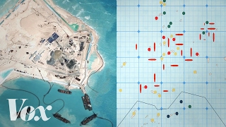 7:25Why China is building islands in the South China SeaVox on China’s island-building and its claims in the South China Sea.
 23:14Why China Will Never Surrender the South China SeaJohnny Harris on why Beijing won’t give up its South China Sea claims despite the 2016 ruling.
Cite this article
Owen Parker. “The floating borders: how maritime law decides who owns the sea.” Eikleaf, 12 May 2026, updated 2 November 2026. https://www.eikleaf.com/the-floating-borders-how-maritime-law-decides-who-owns-the-sea/
Gen AI Disclaimer
Some contents of this page were generated and/or edited with the help of a Generative AI.
Media
Key Sources and References
United Nations Convention on the Law of the Sea (UNCLOS), United Nations, opened for signature December 10, 1982, entered into force November 16, 1994. Full text via the United Nations Division for Ocean Affairs and the Law of the Sea: https://www.un.org/depts/los/convention_agreements/texts/unclos/unclos_e.pdf
United Nations Division for Ocean Affairs and the Law of the Sea, “The United Nations Convention on the Law of the Sea: A historical perspective”: https://www.un.org/depts/los/convention_agreements/convention_historical_perspective.htm
Agreement relating to the Implementation of Part XI of the United Nations Convention on the Law of the Sea, 1994: https://www.un.org/depts/los/convention_agreements/texts/agreement_part_xi/agreement_part_xi.htm
Ronald Reagan, “Statement on United States Actions Concerning the Conference on the Law of the Sea,” July 9, 1982: https://www.reaganlibrary.gov/research/speeches/70982b
Pardo, Arvid, Statement to the First Committee of the United Nations General Assembly, November 1, 1967. Full text via the United Nations Division for Ocean Affairs and the Law of the Sea: https://www.un.org/depts/los/convention_agreements/texts/pardo_ga1967.pdf
Commission on the Limits of the Continental Shelf (CLCS), United Nations. Commission home and record of submissions and recommendations: https://www.un.org/Depts/los/clcs_new/clcs_home.htm · https://www.un.org/Depts/los/clcs_new/commission_submissions.htm · Summary of the Recommendations on the Submission made by Japan, April 19, 2012: https://www.un.org/depts/los/clcs_new/submissions_files/jpn08/com_sumrec_jpn_fin.pdf
Treaty between the Kingdom of Norway and the Russian Federation concerning Maritime Delimitation and Cooperation in the Barents Sea and the Arctic Ocean, September 15, 2010 (entered into force July 7, 2011). Treaty text via United Nations Division for Ocean Affairs and the Law of the Sea: https://www.un.org/depts/los/LEGISLATIONANDTREATIES/PDFFILES/TREATIES/NOR-RUS2010.PDF
Pew Charitable Trusts, “High Stakes on the High Seas,” 2015: https://www.pewtrusts.org/-/media/assets/2015/11/highseas_highstakes_final.pdf
Food and Agriculture Organization of the United Nations, Maldives fisheries country review: https://www.fao.org/4/A0477E/a0477e0y.htm
South China Sea Arbitration (Republic of the Philippines v. People’s Republic of China), PCA Case No. 2013-19, Award, July 12, 2016, and Permanent Court of Arbitration Press Release No. 11, July 12, 2016: https://docs.pca-cpa.org/2016/07/PH-CN-20160712-Award.pdf · https://docs.pca-cpa.org/2016/07/PH-CN-20160712-Press-Release-No-11-English.pdf
Ministry of Foreign Affairs of the People’s Republic of China, “Statement of the Ministry of Foreign Affairs of the People’s Republic of China on the Award of 12 July 2016 of the Arbitral Tribunal in the South China Sea Arbitration Established at the Request of the Republic of the Philippines,” July 12, 2016: https://www.fmprc.gov.cn/nanhai/eng/snhwtlcwj_1/201607/t20160712_8527294.htm
VERA Files, “China avoids criticizing PH, hits Arbitral court,” July 15, 2016: https://verafiles.org/articles/china-avoids-criticizing-ph-hits-u-n-court
US Department of State, Limits in the Seas No. 143, “China: Maritime Claims in the South China Sea,” December 5, 2014: https://www.state.gov/wp-content/uploads/2019/10/LIS-143.pdf
Center for Strategic and International Studies, Asia Maritime Transparency Initiative (CSIS AMTI), “China’s Big Three Near Completion,” March 27, 2017 (updated June 29, 2017). Documents military-grade airstrips, port facilities, and radar installations at Fiery Cross Reef, Subi Reef, and Mischief Reef: https://amti.csis.org/chinas-big-three-near-completion/
Ministry of Foreign Affairs of the People’s Republic of China, spokesperson Mao Ning statement on Okinotori, May 27, 2025. Regular press conference transcript: https://www.mfa.gov.cn/eng/xw/fyrbt/202505/t20250527_11634354.html
Dreyer, June Teufel, “The Curious Case of Okinotori: Reef, Rock, or Island?” Pacific Forum CSIS, PacNet #59, July 18, 2016: https://pacforum.org/publications/pacnet-59-the-curious-case-of-okinotori-reef-rock-or-island/
Yamagata, Hideo, “南シナ海事件と日本:沖ノ鳥島の法的地位” [The South China Sea case and Japan: the legal status of Okinotorishima], Hosei Kenkyu (Shizuoka University) 23, nos. 3–4, 2019. Gives the exposed areas as 7.86 m² (Kitakojima) and 1.58 m² (Higashikojima), via Nagoya University Repository: https://nagoya.repo.nii.ac.jp/records/28384
Lin, Tinghui, “Okinotori: A New Beginning for Taiwan-Japan Maritime Dialogue,” CSIS Asia Maritime Transparency Initiative, June 17, 2016: https://amti.csis.org/okinotori-new-beginning-taiwan-japan-maritime-dialogue/
Tsuruta Jun, “China’s Expansion into the West Pacific: Geographical and Strategic Importance of ‘Okinotorishima’,” Japan Forum on International Relations, January 12, 2023: https://www.jfir.or.jp/en/wp-content/uploads/sites/2/2023/04/230112_TSURUTAJun_en.pdf
Tokyo Metropolitan Government, “Japan’s Southernmost and Easternmost Border Islands: Tokyo’s Okinotorishima and Minamitorishima Islands,” interview with the Keihin River Office, Kanto Regional Development Bureau, Ministry of Land, Infrastructure, Transport and Tourism: https://www.t-borderislands.metro.tokyo.lg.jp/en/interview/interview5.html
International Tribunal for the Law of the Sea (ITLOS), List of Cases, Hamburg (accessed October 2026): https://www.itlos.org/en/main/cases/list-of-cases/
Wright, Thomas J., “Outlaw of the Sea: The Senate Republicans’ UNCLOS Blunder,” Brookings Institution, August 7, 2012: https://www.brookings.edu/articles/outlaw-of-the-sea-the-senate-republicans-unclos-blunder/
Fox News, “Sea Treaty all but dead, 34 GOP senators oppose,” July 16, 2012: https://www.foxnews.com/tech/sea-treaty-all-but-dead-34-gop-senators-oppose
Military and Paramilitary Activities in and against Nicaragua (Nicaragua v. United States of America), International Court of Justice, Judgment of 27 June 1986: https://www.icj-cij.org/case/70
US Department of Defense, Annual Freedom of Navigation (FON) Report; “DOD Releases Fiscal Year 2023 Freedom of Navigation Report,” Seapower, May 9, 2024: https://seapowermagazine.org/dod-releases-fiscal-year-2023-freedom-of-navigation-report/
US Department of State, “Continental Shelf and Maritime Boundaries; Notice of Limits,” Federal Register Vol. 88, No. 244, p. 88470, December 21, 2023 (Public Notice 12244). Official government record of the December 19, 2023 announcement of U.S. extended continental shelf outer limits: https://www.federalregister.gov/documents/2023/12/21/2023-28159/continental-shelf-and-maritime-boundaries-notice-of-limits